Automatic Identification System (AIS) and the Monitoring of Marine Protected Areas and Exclusive Economic Zones
Vast areas of the ocean (millions of km2) have been designated as Marine Protected Areas (MPA), marine reserves, shark sanctuaries and other conservation categories. Even in the absence of conservation categories overlying a nation’s 200-mile offshore exclusive economic zone (EEZ), the EEZ itself must be monitored for compliance. Monitoring conservation areas and EEZs for legal and illegal uses such as fishing and mining is a challenge.
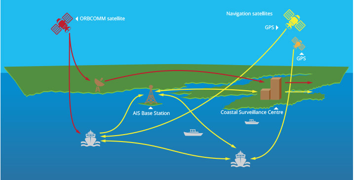
The Automatic Identification System (AIS) may be a useful tool for monitoring the above areas. AIS exists to prevent the collision of vessels and for coastal and island maritime authorities to see vessel traffic within their conservation areas and EEZs. AIS-equipped vessels continuously transmit vessel position, course, speed, identity and other parameters. The information can be seen graphically by other ships and by onshore facilities. AIS base stations along coasts and satellites track AIS-equipped ships. The International Maritime Organization requires AIS on ships ≥300 gross tonnage, and on all passenger ships regardless of size.
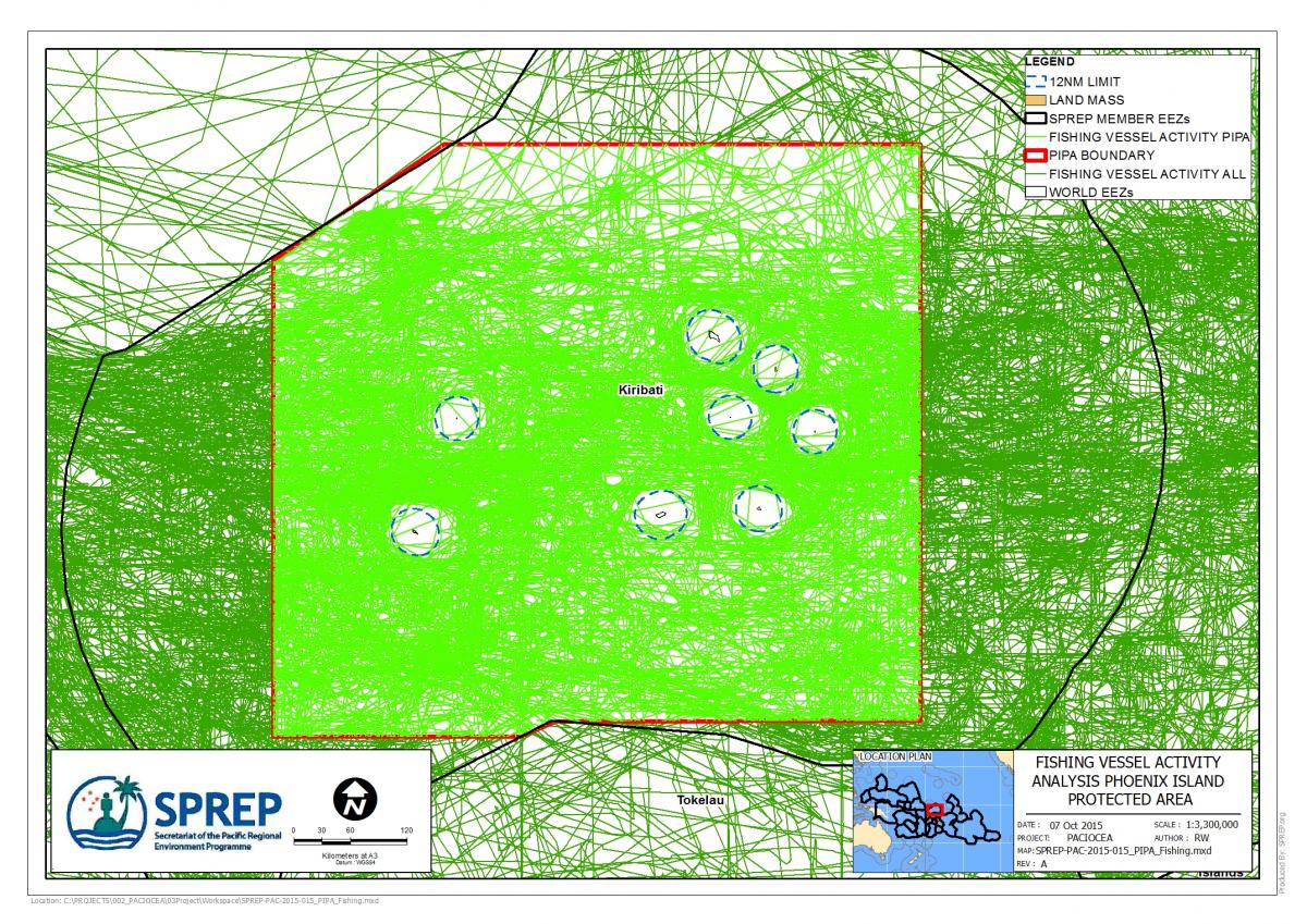
Phoenix Island Protected Area
Fishing Vessels
A simple analysis of archived AIS data from Kiribati’s Phoenix Island Protected Area (PIPA; 408,250 km2 or 11% of Kiribati’s EEZ) gauges the amount of fishing vessel traffic traversing across PIPA during April, 2013 – March, 2014, a period before PIPA was closed to all commercial fishing on January 1, 2015. AIS vessel tracks identified as fishing revealed 115 fishing vessels within PIPA traversing the area for a total distance of 523,686 km (Note: AIS vessel tracks obtained from ExactEarth and fishing vessels identified by stated vessel type and combining data with Fisheries Forum Agency fishing vessel databases). Vessel activity was higher within PIPA (1.28 km/km2) than in all three Kiribati EEZs (1.19 km/km2). The analysis also shows the vessels respecting the 12 nautical mile territorial waters around the atolls and islands of Kiribati. This analysis should stimulate the routine use of AIS data to examine fishing activity in PIPA after the 2015 commercial fishing closure to help effectively manage and govern PIPA.