March 6, 2020
sprep-pa
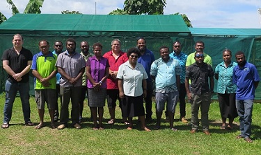
Environment officers in Vanuatu now have the skills to produce basic maps of protected and conserved areas of Vanuatu following training on the upgraded tools and features of the Pacific Islands Protected Area Portal (PIPAP) as well as geographic information systems (GIS). The training utilised free, open-source GIS software and capturing of spatial data out in the field.It was co-organised by the Secretariat of the Pacific Regional Environment Programme (SPREP) and the Department of Environmental Protection and Conservation (DEPC)...