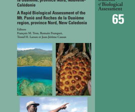
The Mt. Panié RAP survey was led by a partnership between local communities, Province nord (Northern Province), Conservation International (CI) and Dayu Biik, an indigenous conservation non-profit organization. CI and Province nord’s relationships
The independent state of Papua New Guinea (PNG) occupies the eastern half of New Guinea, the world’s largest and highest tropical island and one of the last major tropical wilderness areas on earth.
Conservation International’s Rapid Assessment Program (RAP) is an innovative biological inventory program designed to use scientific information to catalyze conservation action.
The Republic of Fiji consists of approximately 300 islands located roughly 3000 km east of Australia in the Pacific Ocean (between 16o and 20oS, 177oW and 175oE). There are four main islands in the Fiji group: Viti Levu, Vanua Levu, Taveuni and Kadavu.
Here we report the findings from the Marine Rapid Assessment Survey of the coral reefs of the northwest lagoon (Yandé to Koumac) of Nouvelle Calédonie.
This report presents the results of a rapid field assessment of Milne Bay Province, which encompasses the extreme southeastern tip of mainland Papua New Guinea and an extensive offshore area immediately eastward.
Biologically, New Ireland has remained one of the least studied regions of Papua New Guinea (PNG), and the mountainous southern zone has been considered both a high priority for biodiversity conservation and a major “scientific unknown” (Beehler 1993).
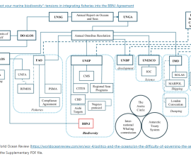
The 2023 Biodiversity Beyond National Jurisdiction (BBNJ) Agreement aims to conserve and sustainably use marine biodiversity in areas beyond national jurisdiction. However, separating fisheries from broader conservation frameworks has led to fragmented governance.
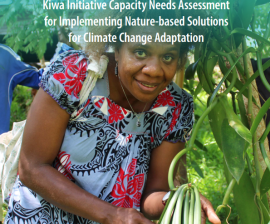
This assessment identifies the capacity-building needs and priorities of local and national public authorities and institutions, representatives from civil societies and communities, and NGOs from the 19 Kiwa-eligible PICTs to: 1.