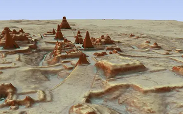
A project to produce detailed maps of all the land on Earth through laser scanning has been revealed by researchers who say action is needed now to preserve a record of the world’s cultural, environmental and geological treasures. Prof Chris Fisher, an archaeologist from Colorado State University, said he founded the Earth Archive as a response to the climate crisis.