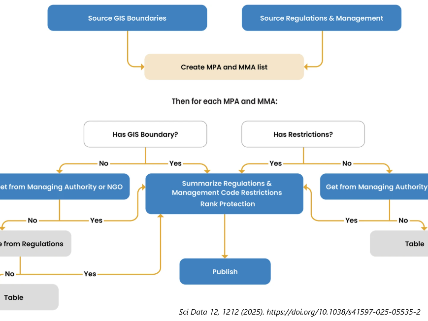
Comprehensive, global, and standardized data on ocean regulations are essential to assess protection levels. They are also key to successfully measuring progress towards 30 × 30 goals. ProtectedSeas’ Navigator is a repository of regulatory and spatial data for over 21,700 unique marine managed areas globally, with summaries of restricted fishing and marine activities extracted from official regulations. Navigator allows data users at the global, national, or local level to (1) explore overlapping regulations, (2) visualize where and what human activities are regulated, and (3) use a Level of Fishing Protection (LFP) score and other indicators in analysis with other data sets. Navigator’s LFP scoring system aligns well with other data sources and assessment methods, which seek to identify highly and fully protected areas. Navigator includes over 50 standard attributes per area and each area is cross-referenced to the applicable source documents and the World Database on Protected Areas, where appropriate.


