Across the world, many countries underreport their greenhouse gas emissions in their reports to the United Nations, a Washington Post investigation has found. An examination of 196 country reports reveals a giant gap between what nations declare their emissions to be vs.
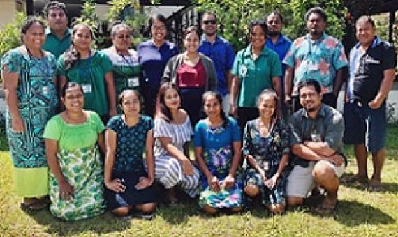
Protected Area Practitioners And Government Stakeholders Of Kiribati Are Now Equipped With The Hands-On, Practical Knowledge Of Finding Relevant Up-To-Date Data, Information Resources And Technical Guidance On Protected And Conserved Area Management. It follows a virtual training on the tool
Advancing Sustainable Development and Protected Area Management with Social Media‐Based Tourism Data
Sustainable tourism involves increasingly attracting visitors while preserving the natural capital of a destination for future generations. To foster tourism while protecting sensitive environ‐ ments, coastal managers, tourism operators, and other decision‐makers benefit from information about where tourists go and which aspects of the natural and built environment draw them to particular locations. Yet this information is often lacking at management‐relevant scales and in remote places. We tested and applied methods using social media as data on tourism in The Bahamas.
Gridded Population of the World, v.4
The Gridded Population of the World, Version 4 (GPWv4): Population Density, Revision 11 consists of estimates of human population density (number of persons per square kilometer) based on counts consistent with national censuses and population registers, for the years 2000, 2005, 2010, 2015, and 2020. A proportional allocation gridding algorithm, utilizing approximately 13.5 million national and sub-national administrative units, was used to assign population counts to 30 arc-second grid cells.
Bio-ORACLE 2.1 - Marine data layers for ecological modelling
Bio-ORACLE is a set of GIS rasters providing geophysical, biotic and environmental data for surface and benthic marine realms. The data are available for global-scale applications at a spatial resolution of 5 arcmin (approximately 9.2 km at the equator).
Linking biodiversity occurrence data to the physical and biotic environment provides a framework to formulate hypotheses about the ecological processes governing spatial and temporal patterns in biodiversity, which can be useful for marine ecosystem management and conservation.
General Bathymetric Chart of the Oceans
GEBCO's aim is to provide the most authoritative publicly-available bathymetry of the world's oceans. It operates under the joint auspices of the International Hydrographic Organization(IHO) and the Intergovernmental Oceanographic Commission (IOC) (of UNESCO).
GEBCO produces and makes available a range of bathymetric data sets and products. This includes a global bathymetric grid; gazetteer of undersea feature names, a Web Map Service and printable maps of ocean bathymetry.
Global Seafloor Geomorphic Features - Blue Habitats
Conservation International, GRID-Arendal and Geoscience Australia recently collaborated to produce a map of the global distribution of seafloor geomorphic features. The global seafloor geomorphic features map represents an important contribution towards the understanding of the distribution of blue habitats. Certain geomorphic feature are known to be good surrogates for biodiversity. For example, seamounts support a different suite of species to abyssal plains.
Global Distribution of Seamounts and Knolls
This dataset shows the global distribution of seamounts and knolls identified using global bathymetric data at 30 arc-sec resolution. A total of 33,452 seamounts and 138,412 knolls were identified, representing the largest global set of identified seamounts and knolls to date. Seamount habitat was found to constitute approximately 4.7% of the ocean floor, whilst knolls covered 16.3%.
The research leading to these results received funding from the European Community’s Seventh Framework Programme, and from the International Union for Conservation of Nature (IUCN).
Volcanoes of the World - Global Volcanism Program
The Smithsonian Institution's Global Volcanism Program (GVP) is housed in the Department of Mineral Sciences, National Museum of Natural History, in Washington D.C. We are devoted to a better understanding of Earth's active volcanoes and their eruptions during the last 10,000 years.
Global Mangrove Distribution - Global Mangrove Watch
The Global Mangrove Watch (GMW) is a collaboration between Aberystwyth University (U.K.), solo Earth Observation (soloEO; Japan), Wetlands International the World Conservation Monitoring Centre (UNEP-WCMC) and the Japan Aerospace Exploration Agency (JAXA).