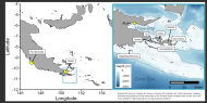
In 2014, the Vanuatu Council of Ministers (Decision No. 172/2014) supported the development of a national ocean policy and marine spatial plan, and in doing so, established an Ocean Policy Subcommittee to guide these processes. Now, as the Ocean Policy Implementation Sub-Committee, one of their tasks was to identify Vanuatu’s special and/ or unique marine areas (SUMAs). This report brings together data, literature and the outputs of a dedicated workshop synthesising information about the areas identified. The areas were described, justified and scored according to four criteria: geographic explicitness, justification, information sources and legal obligations associated with each site. Each site was described in as much detail as the available information sources allowed, and was given a score out of 12. Sites were grouped into large-scale, offshore sties and finer-scale, mainly inshore sites; the former were grouped into broad geographic regions (southern, central and northern) and the latter were grouped into Provinces. Workshop participants identified 100 SUMAs, of which 11 were offshore and 89 were inshore.