About
- Terms of Reference
- Action Plan 2014 – 2020
- PAWG Presentation at Annual Meeting, Suva, Fiji, July 2015
Members
- American Samoa Environmental Protection Agency
- Conservation International (CI)
- Coral Reef Advisory Group (CRAG) – American Samoan Government
- Deutsche Gesellschaft für Internationale Zusammenarbeit (GIZ)
- Marine Areas Network (FLMMA)
- Food and Agriculture Organization (FAO)
- International Union for Conservation of Nature - Oceania Regional Office (IUCN-ORO)
- Protected Areas Learning and Research Collaboration (PALRC)
- The Nature Conservancy (TNC)
- World Wide Fund (WWF)
- Wildlife Conservation Society – Fiji Country Programme
- Wildlife Conservation Society, Melanesia Program
Note - As of November 2022, the PAWG has been rebranded to the Pacific Area-based Conservation Network (PACoN), with a new terms of reference and membership. More information to come - WATCH THIS SPACE...
The ocean’s enforcement gap
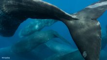
On paper, the sea is increasingly protected. Governments have designated vast marine protected areas (MPAs) and pledged to conserve 30% of the ocean by 2030. Maps shaded in reassuring blues now circulate widely. Yet the reality offshore often looks much the same as before.
The Phoenix Islands Protected Area Management Plan 2015 - 2020
The Phoenix Islands lie in the heart of the Pacific Ocean and are one of the most remote island chains on Earth. They are located approximately halfway between Fiji and Hawaii. The largest atoll, Kanton, is 1,750 km (1,087 miles) from the Kiribati capital Tarawa.
The PNG-METT : A method for assessing effectiveness in Papua New Guinea's protected areas
In 2015, 2016, the Government of Papua New Guinea (PNG), through its Conservation and Environmental Protection Authority (CEPA) and with the support of United Nations Development Program (UNDP), organised an evaluation of its protected areas, as part of the process to improve management eff
The relationship between Indigenous Peoples' lands and conservation: A systematic literature review
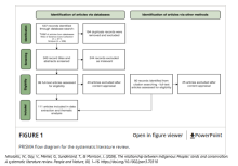
A growing body of peer-reviewed literature is focused on the relationship between Indigenous Peoples' lands (Indigenous lands) and conservation outcomes.
The Republic of the Marshall Islands - State of Environment Report 2016
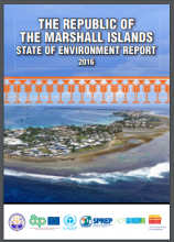
This report updates the 1992 State of Environment report with the latest findings from the Marshall Islands. Environmental reporting is defined as a requirement for RMI in the ‘Office of Environmental Planning and Policy Coordination (OEPPC) Act 2003’.
The Right to a Healthy Environment in Practice: A Decade Before the Courts (2015-2025)
Since its initial articulation in the early 1970s, the sphere of legislative and judicial practices regarding the right to a healthy environment (R2HE) has evolved substantially.
The role of Indigenous peoples and local communities in effective and equitable conservation
Debate about what proportion of the Earth to protect often overshadows the question of how nature should be conserved and by whom.
The status and conservation needs of the Micronesian Megapode (Megapodius laperouse laperouse) across the Mariana archipelago
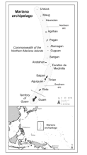
Accurate baseline data for wildlife populations are important to track trends of these
The three screen doors: Can marine “protected” areas be effective?
The great majority of marine protected areas (MPAs) fail to meet their management objectives. So MPAs can be effective conservation tools, we recommend two paradigm shifts, the first related to how they are located and the second related to how they are managed.
The world agreed to protect 30% of the ocean by 2030 – but marine protection can’t be judged by area alone
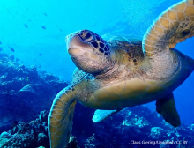
The ocean is home to some of the richest biodiversity on Earth.
The ‘Blue Pacific’: ocean governance and planetary health
Equitable ocean governance is critical, as the oceans are essential to the planetary system and global health.oceans cover 71% of Earth’s surface and are crucial to our planet’s life-support system.
The ‘Paper Park Index’: Evaluating Marine Protected Area effectiveness through a global study of stakeholder perceptions
Governments around the world are increasingly committed to reaching terrestrial and marine conservation goals. But achieving such commitments is challenging, and conservation targets that are reached on paper, e.g., in terms of square kilometers protected, can be misleading.
The Pacific Islands Roundtable for Nature Conservation (PIRT)
The Pacific Islands Roundtable for Nature Conservation (PIRT) is a coalition of nature conservation and development organizations, governments, inter-government, donor agencies and community groups created to increase effective conservation action in the Pacific Island Region. It w
Tonga - Rapid Biodiversity Assessment (BIORAP) of the Vava'u Archipelago
This report presents the results and recommendations of a Biological Rapid Assessment Programme (BIORAP) carried out in the marine and terrestrial environments of the Vava’u Archipelago, Tonga, from 13 to 28 February 2014.
Tonga National Marine Ecosystem Service Valuation
The exclusive economic zone of Tonga, nearly 700,000 km2 of ocean, is 1000 times larger than the country’s land area. Coastal and marine resources provide the Government of Tonga, businesses and households many real and measurable benefits.
Towards a systematic framework to assess restoration success of interventions in coral reef ecosystems
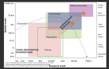
An ecosystem is defined as a collection of organisms that move energy within and outside of a system, while sustaining both the system itself and the multiple services that benefit humanity.
Towards an Understanding of Marsupial Interchange between Australia and New Guinea
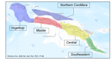
A review of the geology, palaeontology, genetic, and morphology studies indicates that during the mid-Miocene to Pliocene, New Guinea consisted of four island Blocks (Vogelkop, Maokop, Central, and Southeastern). The initial dispersal of marsupials from Australia was into the Vogelkop Block.
Towards reducing misrepresentation of national achievements in marine protected area targets
Parties to the Convention on Biological Diversity (CBD) adopted 20 targets, known as the Aichi Targets, to benchmark progress towards protecting biodiversity.
Traditional Ecological Knowledge and practices associated with the Vanate (Raggiana Bird of Paradise, Paradisaea raggiana) along the Kokoda Track in Central Province, Papua New Guinea
Context. Traditional Ecological Knowledge (TEK) is lost due to the increase of urbanisation, and the lack of transfer of this knowledge to younger generations. Aims.
Traditional knowledge and the BBNJ instrument
Indigenous Peoples and local communities (IPLCs) are the holders of a vast amount of traditional knowledge of the ocean and its resources.
Turning the Tide for Coral Reefs: the ICRI Plan of Action 2021-2024
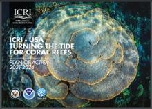
The twin crises of climate change and biodiversity loss have brought into stark relief the need for greater collaboration and action at the international level to conserve, manage, and restore coral reefs.
Turtle research and monitoring database: a TREDS of summary Pacific turtle data recorded from 1970 to 2018
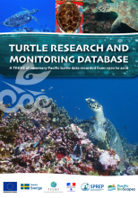
The Turtle Research and monitoring Database System (TREDS) was developed in 1993, to allow members of the Secretariat of the Pacific Regional Environment Programme (SPREP) to store, collate, and organise their data for research, monitoring and reporting.
Twenty-five years of misinterpreting the biodiversity hotspot approach
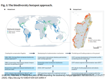
A quarter of a century after its publication, the biodiversity hotspot concept remains one of the most cited and influential frameworks in conservation science.
Unexpected expansion and regrowth in Earth’s mangrove forests over the past four decades
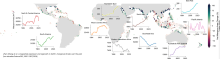
Mangrove forests are coastal habitats that serve as nurseries for economically important fisheries.
United Nations List of Protected Areas 2018
The 2018 UN List provides up-to-date information on marine and terrestrial protected areas globally, and identifies those protected areas that have been the subject of management effectiveness evaluations.
Unity of Nature and Man: a new vision and conceptual framework for the Post-2020 Global Biodiversity Framework
People live in nature. However, substantial evidence confirms that, under the pressure of anthropogenic alteration, nature is being fragmented, imperiled and becoming less able to provide essential services.
Unlocking the potential of other effective area-based conservation measures (OECMs) for achieving conservation targets: A global scoping review
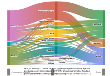
Other Effective Area-based Conservation Measures (OECMs), introduced by the Convention on Biological Diversity (CBD), refer to areas outside formal protected-area networks that deliver effective and enduring in situ biodiversity conservation.
Use of surrogate species to cost-effectively prioritize conservation actions
Conservation efforts often focus on umbrella species whose distributions overlap with many other flora and fauna.
Valuing nature conservation
Rigorous analysis of opportunities to expand nature conservation can help determine where natural capital could have the biggest impact on climate, jobs, and health.
Vanuatu ecosystem and socio-economic resilience analysis and mapping (ESRAM)
Ecosystem and Socio-economic Resilience Analysis and Mapping (ESRAM) is the first stage of PEBACC. This report presents the results of the ESRAM undertaken by Griffith University for the Republic of Vanuatu (hereafter Vanuatu) and Tanna Island (heareafter Tanna).
Vanuatu Interactive Marine Atlas
While the ocean covers more than two thirds of the Earth’s surface, the oceanic territory of Vanuatu is 57 times larger than its land territory. With an exclusive economic zone (EEZ) of 680,000 km2, Vanuatu is a large ocean state.
Vanuatu National Biodiversity Strategy and Action Plan [NBSAP] 2018-2030
Vanuatu signed and ratified the United Nations Convention on Biological Diversity (UNCBD) joining other 190 CBD parties to protect our global biodiversity. Vanuatu’s first National Biodiversity Strategy and Action Plan (NBSAP) was developed and endorsed in November 1999.
Vanuatu National Marine Ecosystem Service Valuation
This study aimed to estimate the economic value of seven marine and coastal ecosystem services1 in Vanuatu.
Vanuatu National Plan of Action for Seabirds, Sharks and Marine Turtles 2024-2028
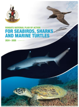
Seabirds, sharks and marine turtles are important apex species in the marine food-chain, and they maintain marine ecosystem health.
Vemööre Declaration : Commitments to nature conservation action in the Pacific Islands region, 2021-2025

“Vemööre” is a term in the Kwenyï language spoken by people from the Isle of Pines in New Caledonia.
Video - An ingenious proposal for scaling up marine protection | The Nature Conservancy
Island and coastal nations need to protect their waters to keep the oceans healthy. But they often have lots of debt and aren't able to prioritize ocean conservation over other needs.
Video - BIOPAMA grantees' voices: MELAD Kiribati
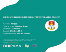
Experiences from the Kiribati Ministry of Environment, Lands and Agricultural Development regarding their medium grant under the EU-ACP BIOPAMA Action Component focusing on management interventions for the Kiritimati Island Conservation Protected Area.
Video - National Protected Areas Forum highlights 2021, Papua New Guinea
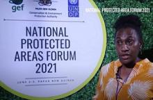
The aim of the National Protected Areas Forum was to fulfill mandates and strengthen policies to protect the country’s abundant natural assets into the future to benefit all life and future generations.
Video - Palau: Nest of Life
Palauans describe the environment as "Lukel a Klengar" - the nest of life.
Visitors Count! Guidance for protected areas on the economic analysis of visitation
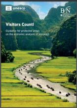
This guidance document aims to build awareness, knowledge, and capacity internationally on how to best undertake economic evaluations of tourism in protected areas, and thereby contribute towards a globally acknowledged standard methodology.
Voluntary Biodiversity Credits: A Guide For Business
This guide aims to help businesses navigate the rapidly evolving voluntary biodiversity credit (VBC) markets and decide
whether and how to engage in VBCs.
Vulnerability of marine megafauna to global at-sea anthropogenic threats
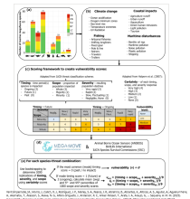
Marine megafauna species are affected by a wide range of anthropogenic threats. To evaluate the risk of such threats, species’ vulnerability to each threat must first be determined.
Vuri Clan Forest Conservation Area Management Plan - Choiseul Province, Solomon Islands
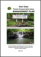
This Management Plan was prepared by the representatives of the Vuri Clan of Sikipozo Tribe in partnership with the Natural Resources Development Foundation (NRDF), Ecological Solutions Solomon Islands (ESSI), World Wide Fund for Nature (WWF-SI), the Ministry of Forestry and Research (National He

WESTERN PACIFIC BLUE CORRIDORS CHARTING A COURSE FOR A CONNECTED BLUE PACIFIC STEWARDSHIP

Marine megafauna - whales, dolphins, porpoises, turtles, sharks, tuna and other migratory species - depend on a connected and healthy ocean.